
ENSO ADVISORY NO.4 1138 AM EDT Tue. Jily 21, 2026
SYNOPSIS
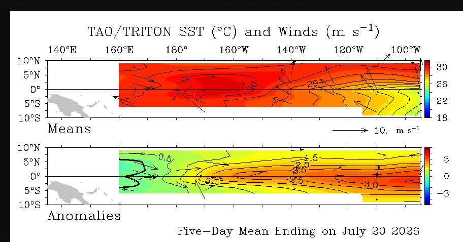
Equatorial Pacific sea surface temperatures are well above average and consistent with an active, strengthening El Niño. Across all major monitoring agencies, the central and eastern equatorial Pacific is showing strong positive Sea surface temperature anomalies, with several Niño regions at record high or near record levels for the season.
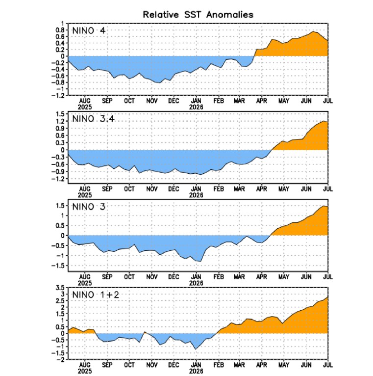
El Niño is present and strengthening, according to the Climate Prediction Center. Equatorial sea surface temperatures are above average across the central and eastern Pacific. The latest Niño region anomalies values are: Niño 1+2: +3.26 °C, Niño 3: +2.08 °C, Niño 3.4: +1.82 °C, and Niño 4: +1.22 °C. These values indicate substantial warming across the basin, strongest in the eastern Pacific.
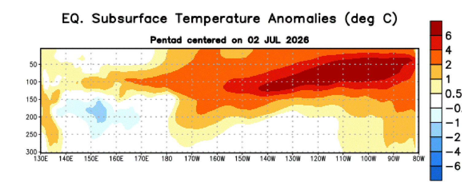
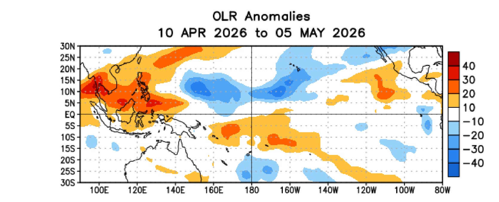
Since mid April 2026, above average sea surface temperatures have expanded and intensified across the east central and eastern equatorial Pacific. The equatorial Pacific recorded its warmest April on record, signaling the onset of El Niño conditions. Daily global sea surface temperatures reached record highs for June 2026, driven largely by warming in the equatorial Pacific.
EFFECT
Strong positive sea surface temperature anomalies across the equatorial Pacific confirm active El Niño. The warmest anomalies are in the eastern Pacific, a hallmark of a mature or strengthening El Niño event. These conditions are likely to influence global weather, including: Altered rainfall patterns Increased likelihood of marine heatwaves and a Potential for more extreme storms and heat events.
Warmer-than-normal conditions for most of the U.S. through summer and fall 2026. El Niño impacts peak in late fall-winter into early spring, when the jet stream shifts south and becomes more active. Storm tracks strengthen across the southern tier, increasing rainfall and severe weather potential. Atlantic hurricane activity is typically suppressed, while Pacific hurricane activity increases.
Warmer-than-normal temperatures favored for much of the East in ASO 2026. Winter storm tracks may shift south, sometimes reducing snow potential in the northern Northeast—but strong El Niño can still produce major nor’easters depending on blocking patterns (this is an inference based on typical El Niño dynamics). Above-normal precipitation possible in parts of the Ohio and Tennessee Valleys, which can influence downstream storm development.
FORECAST
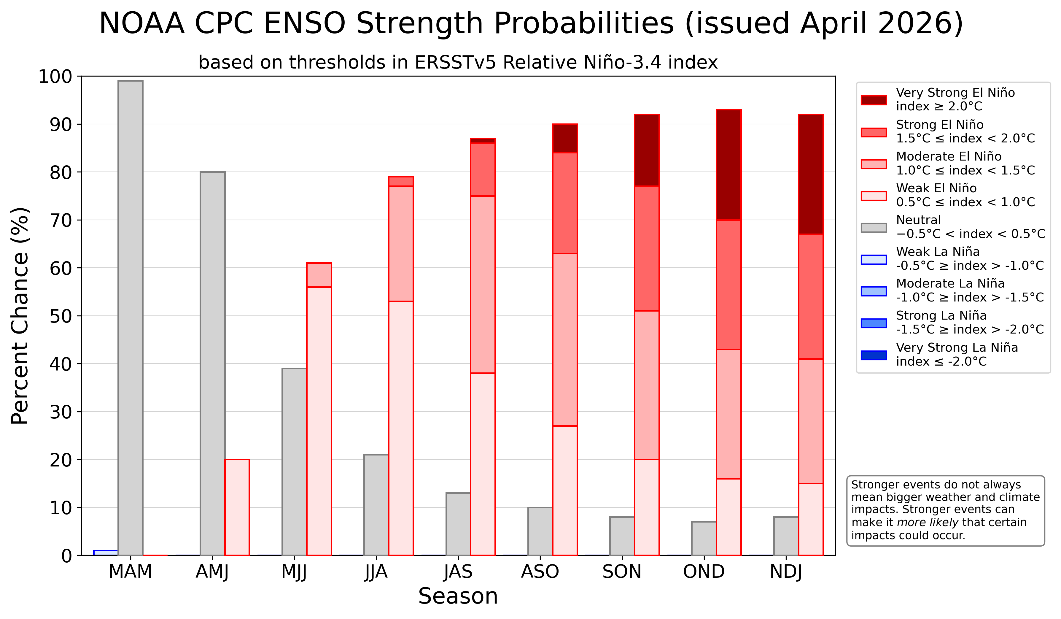
El Niño is ongoing and is forecast to strengthen into a very strong event through late 2026, with extremely high confidence it will persist into early 2027. This is the official outlook from NOAA’s Climate Prediction Center, the World Meteorological Organization, and experimental model guidance from GFDL.
The Climate Prediction Center forecasts a moderate to strong warm episode by the end of the year, with a 55% chance of occurrence. There is also a 37% chance that the warm episode could reach a very strong phase, defined by surface sea temperature anomalies exceeding 2°C.
ENSO Live Dashboard
Loading data...
 Jim Munley, Jr.
http://www.www.jimmunlwywx.com/